
Lhotse
लहोत्से
Earth's 4th-highest mountain
नेपालीमा पढ्नुहोस् · हिंदी में पढ़ें
- नेपाली · English · हिंदीRead in your language
- CitedEvery fact sourced
- Ad-freeNo ads, no tracking
Lhotse is the fourth-highest mountain on Earth, after Mount Everest, K2, and Kangchenjunga. At an elevation of 8,516 metres (27,940 ft) above sea level, the main summit is on the border between the Tibet Autonomous Region of China and the Khumbu region of Nepal.
Quick facts
- Type
- mountain wd
- Located in
- Sagarmatha Zone (zone of Nepal) › Eastern Development Region (development region of Nepal) wd
- Elevation
- 8,516 m wd
- Prominence
- 610 m wd
- Mountain range
- Mahalangur Himal wd
- Coordinates
- 27.9617° N, 86.9333° E wd
Nearby places
- Lhotse Shar — 1 km
- South Col — 1 km
- South Summit — 3 km
- Hillary Step — 3 km
- Mahalangur Himal — 3 km
- Mount Everest — 3 km
In the news All news →
Related
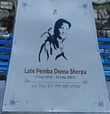 Pemba Doma Sherpa
 Mount EverestEarth's highest mountain
 HimalayasMountain range in Asia
 KathmanduCapital and largest city in Nepal
 Kangchenjunga3rd-highest mountain on Earth
 Annapurna (mountain range)Mountain range in the Himalayas
 Dhaulagiri7th-highest mountain on Earth
 MakaluWorld's 5th-highest mountain
 Cho Oyu6th-highest mountain on Earth
 Manaslu8th-highest mountain on Earth
 PokharaMetropolitan city in Gandaki Province, Nepal
 LumbiniHistorical city in Lumbini Province, Nepal
Questions
- Where is Lhotse located?
- Lhotse is located in Sagarmatha Zone, Eastern Development Region, Nepal.
- What is the elevation of Lhotse?
- Lhotse is at an elevation of 8,516 m above sea level.
Sources
- Wikipedia (English): Lhotse · CC BY-SA 4.0
- Wikipedia (Nepali): लहोत्से · CC BY-SA 4.0
- Wikidata item Q168702 · CC0 1.0
- Image: Lhotse-fromChukhungRi.jpg by Uwe Gille (CC BY-SA 3.0)

Last updated · facts checked 17 November 2026
Cite this page
"Lhotse". DigiNepal. Last updated 17 November 2026. https://diginpl.com/places/lhotse. Retrieved 17 November 2026.
Text from the Wikipedia article Lhotse, licensed under CC BY-SA 4.0. This page's text is shared under the same licence. Facts from Wikidata (CC0). Image: Lhotse-fromChukhungRi.jpg — Uwe Gille, CC BY-SA 3.0.